Eyes in the Sky: Drones in Environmental Compliance and Engineering

Environmental and engineering projects depend on good data, regular check-ins, and solid documentation. But as projects get bigger and expectations rise, the old “boots on the ground” approach isn’t always enough. That’s where drones come in, giving us faster, clearer, and smarter ways to gather information, keep an eye on sites, and make better decisions.
Drones are now a practical part of environmental and engineering work, from saving money on data collection to capturing aerial views that reveal what ground inspections can miss. At this point, the question isn’t if you’ll use drones in your compliance or monitoring program, but when and how. If you’re managing municipal projects, running an environmental program, or coordinating a construction site, drones could be the key to making your work faster, easier, and more insightful.
Why Use Drones in Environmental and Engineering Projects?
At a basic level, drones – also known as Unmanned Aerial Vehicles (UAVs) – offer a new perspective. Equipped with high-resolution cameras and sometimes other sensors (thermal, LiDAR, multispectral), drones allow teams to capture site conditions in ways that were difficult, dangerous, or cost-prohibitive in the past.
Here are a few ways they’re making a difference:
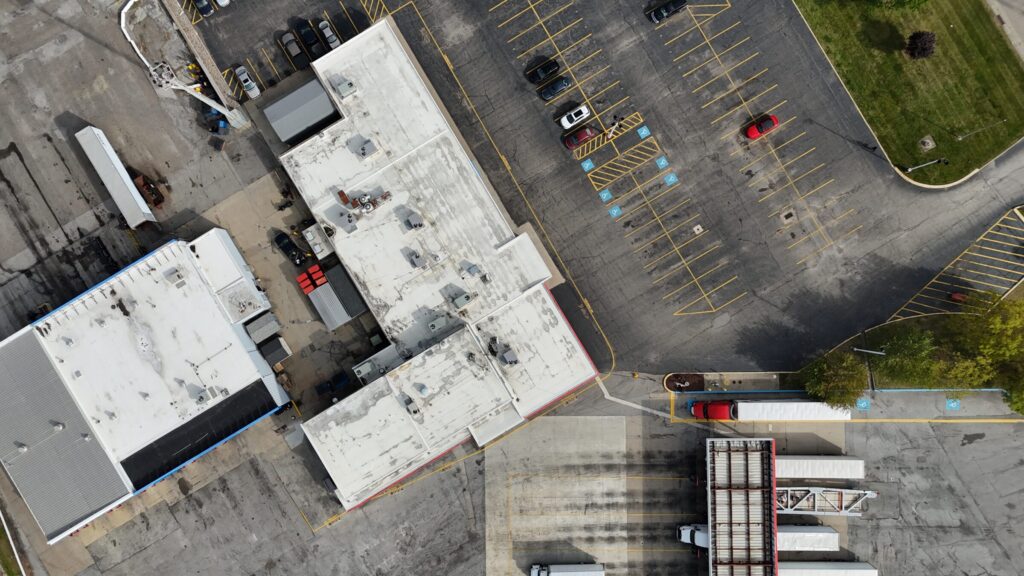
- Site Inspections & Documentation: Regular flyovers help monitor environmental compliance, construction progress, erosion control, and site access conditions. A 20-minute drone flight can produce more usable imagery than an entire afternoon walking a site.
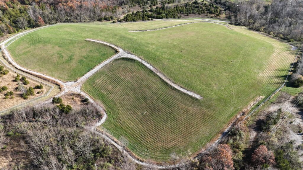
- Stormwater & Erosion Monitoring: Drones can quickly survey drainage paths, sediment basins, and slopes, even after heavy rain events, allowing issues to be flagged and addressed quickly. (Learn more about our stormwater engineering and permitting services.)
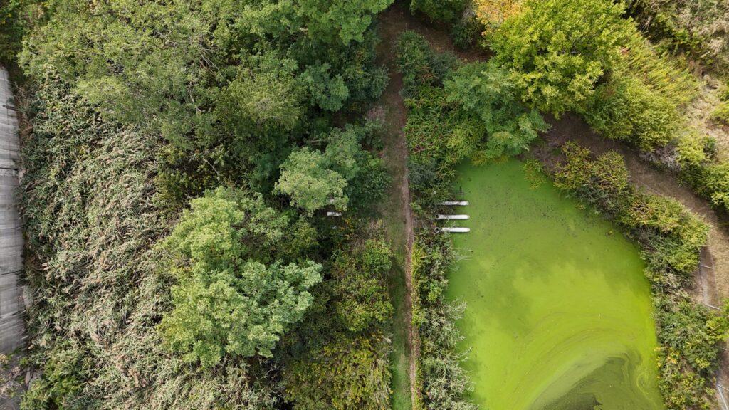
- Vegetation and Wetland Assessments: Aerial views help identify encroachment, health of vegetation, and unpermitted impacts, without disturbing sensitive areas.
- Volume Calculations and Grading Checks: Photogrammetry tools can create 3D models that assist in estimating stockpile volumes or checking cut-and-fill operations.
All of these applications support better compliance with environmental permits, more detailed reporting, and less rework due to overlooked issues.
The Power of Aerial Photography
Perhaps one of the most compelling reasons to integrate drones into your workflow is the value of photography. Aerial images, especially wide-angle shots, offer a comprehensive view that ground photos simply can’t.
Imagine comparing two inspection reports: one with a few ground-level photos of a detention basin, and another with overhead shots showing upstream and downstream conditions, vegetation coverage, inlet structure wear, and sediment buildup. The aerial set immediately gives a better understanding of the system’s overall condition and context.
This broader visibility:
- Supports more confident decision-making in maintenance and operations.
- Helps communicate clearly with clients, regulators, and stakeholders.
- Builds a visual history over time, which can be useful for defending against compliance claims or tracking degradation.
Photos from a wide-angle drone camera aren’t just for documentation – they’re tools for analysis, forecasting, and communication.
Is Aerial Drone Imagery Worth the Cost?
Incorporating aerial drone imagery into environmental compliance and engineering projects offers significant advantages that can enhance decision-making and project outcomes. For property owners, drone-captured images provide a comprehensive overview of their assets, enabling proactive maintenance and efficient resource allocation.
Every organization will be different, but it’s clear that bringing drones into the mix enhances the quality and efficiency of inspections, leading to better-informed decisions and improved project outcomes.
If the team you are hiring to operate the drone has experience flying and a good understanding of what they are looking for, the additional equipment and labor cost to include basic aerial photo or video is minimal compared to the benefits gained.
The more important question is whether more robust data collection is desired to make a more informed decision about maintenance or other site solutions being considered. This can include thermal imaging, photogrammetry, LiDAR, high-powered zoom, fixed wing surveys, and more.
Final Thoughts
Using drones for environmental compliance and engineering work isn’t just a trend – it’s becoming an expectation. The cost of adoption has dropped, and the return on investment in terms of data quality, decision support, and documentation is increasingly hard to ignore.
What’s most exciting is how drones help teams see more, understand more, and ultimately, do better work. Whether it’s capturing the exact conditions of a swale after a storm or mapping a site before a regulator visit, drones offer a powerful new layer of insight, and one that flies well above the status quo.
PSARA’s Perspective
In recent years, our team has developed an in-house drone program focused on aerial photography, and the advantages have been substantial. The high-resolution images captured have significantly enhanced our planning processes, allowing for more precise assessments and strategic decision-making. These visuals have also improved our client recommendations by providing clear, comprehensive views of project sites, leading to more informed and effective solutions. Internally, the drone imagery has fostered better communication among team members, ensuring everyone has a shared understanding of project conditions. Collectively, these benefits have contributed to more successful project outcomes and increased client satisfaction.
Whether you’re managing a facility, overseeing a construction project, or running an environmental program, aerial imagery can offer the clarity you need to make smarter, faster decisions. If you’re curious how drone photos could support your team or improve how you manage your property, we’d be happy to show you what’s possible.